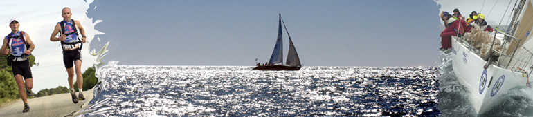
The Race Course
A scenic tour around the coast of Tasmania from Beauty Point across to the unique Flinders Island with its granite mountains, to the holiday resort of Coles Bay on the east coast to the historic State Capital, Hobart in the south.
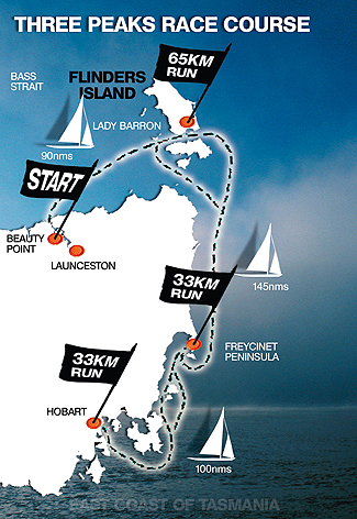
The Race Course
The race is divided into three legs of two sections consisting of a sailing and running leg.LEGS 1 and 2

The race starts on the Tamar River at Beauty Point just north
of Launceston and competitors proceed by yacht to Lady Barron on Flinders Island.
When they arrive (no matter what time of the day or night), TWO CREW MEMBERS are
landed so that they can run to the top of Mt Strzelecki and back. They travel via
the Coast Road, Badger Corner Road, Big River Road and Trousers Point Road to the
mountain, returning to their vessels via the Trousers Point Road, Lady Barron Road
and Coast Road.
SAILING DISTANCE: 90 nms; RUN: 65 kms; ASCENT: 756 m.

LEGS 3 and 4
SAILING DISTANCE: 145 nms; RUN: 35 kms; ASCENT: 620 m.
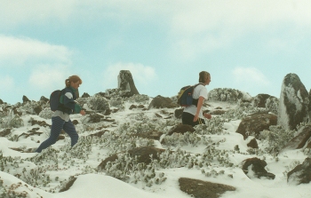
An overnight Mt Wellington blizzard was a surprise race experience for the last leg.
LEG 5 and 6
As the sailing course is optional, some crews choose to sail, row or pedal through the Denison Canal at Dunalley to save time. The canal is not open at night and teams have to consider wind and tide to determine if reducing the sailing distance by about 30 miles is of advantage.
SAILING DISTANCE: 100 nms; RUN: 33 kms; ASCENT: 1270 m.
APPROXIMATE TOTAL DISTANCES:
SAILING DISTANCE: 335 nms; RUN: 133kms; ASCENT: 2646m.